7th Grade Position and Direction Worksheets
What Are Bearings and Why Do 7th Graders Study Them?
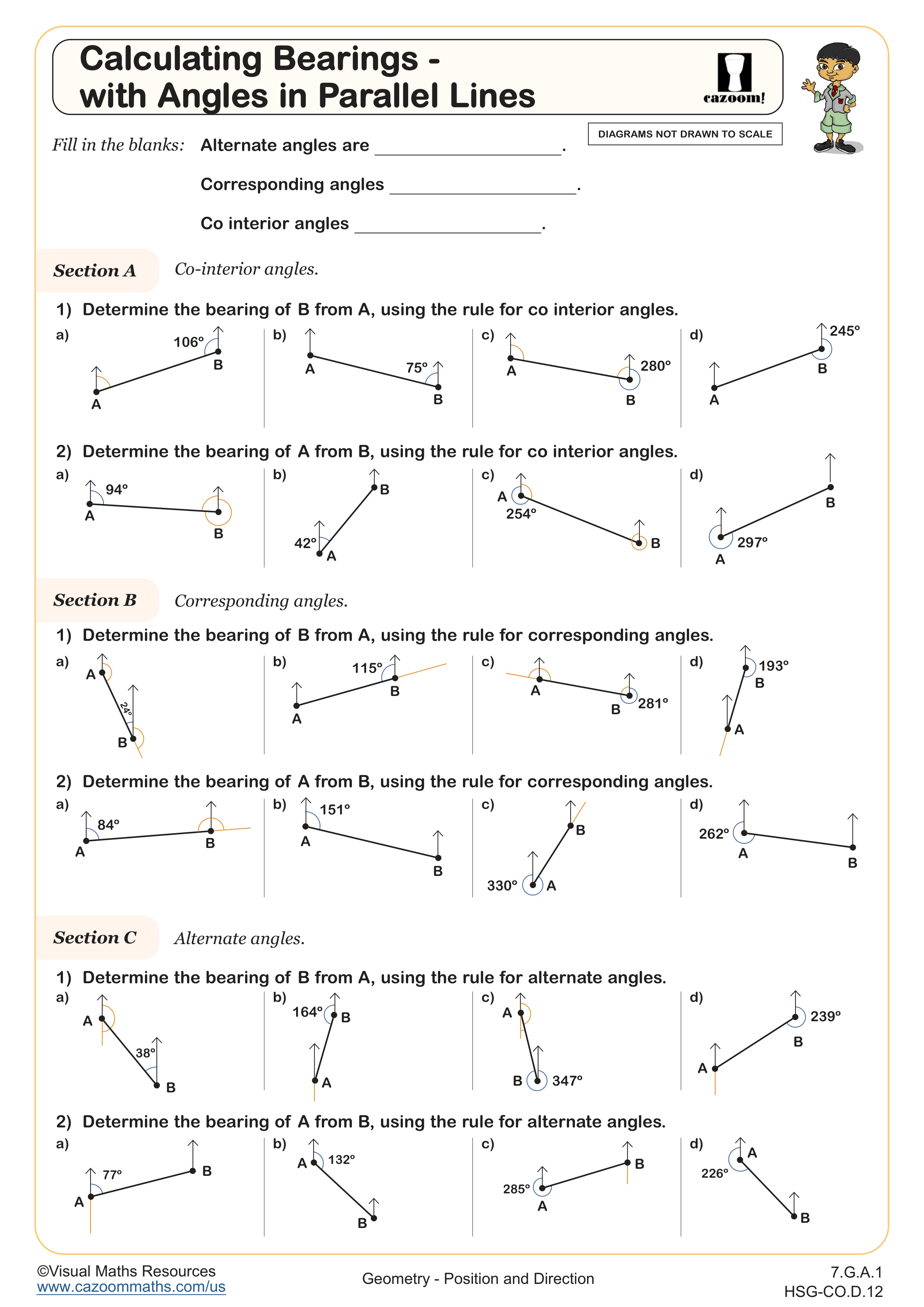
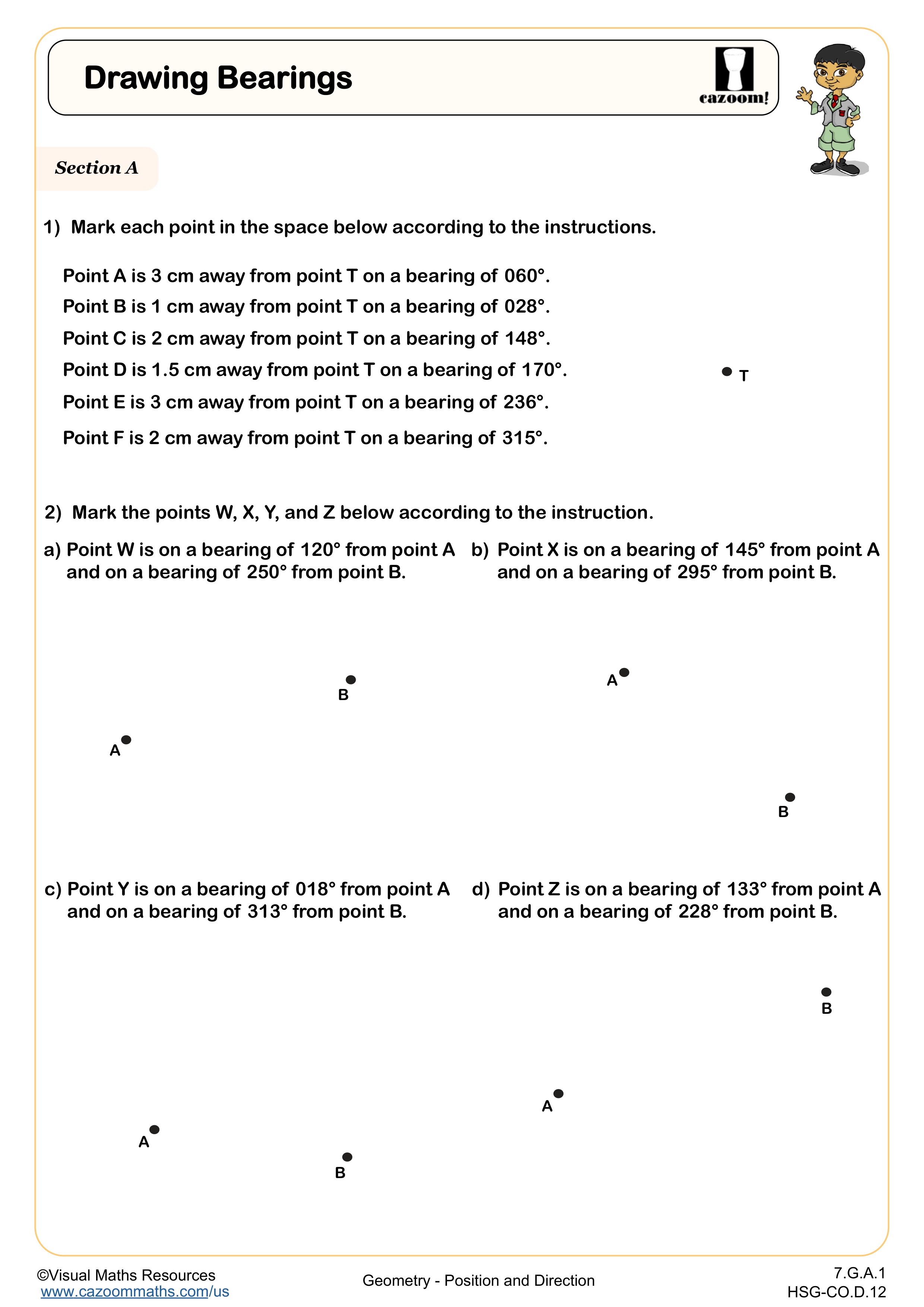
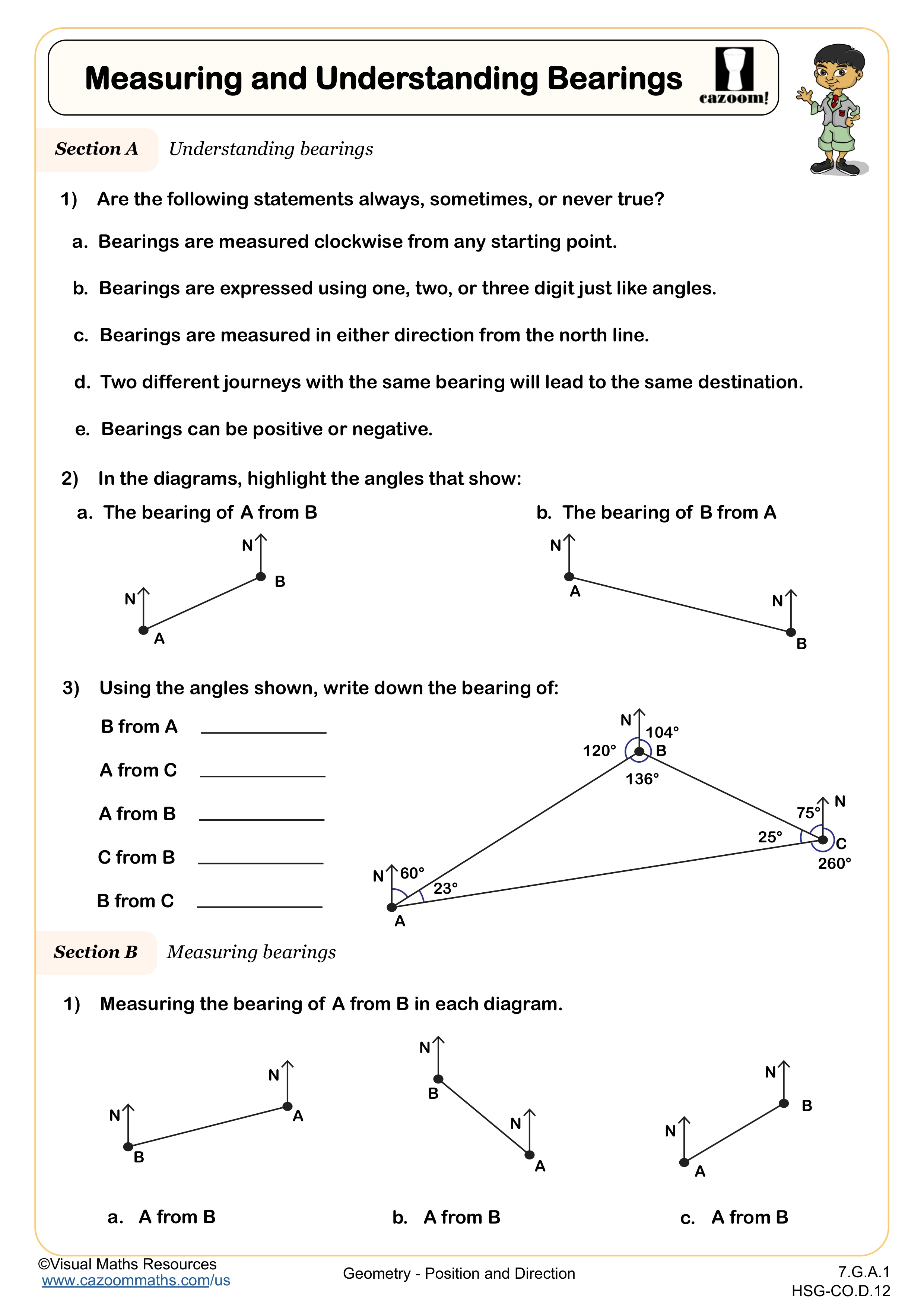
Bearings are angles measured clockwise from north, expressed as three-digit numbers from 000° to 360°. This topic appears in 7th grade geometry standards as students extend their understanding of angles and direction beyond basic compass points. Bearings connect angle measurement with real-world navigation, preparing students for more advanced work with vectors and trigonometry in high school.
Students often struggle with the convention of always measuring clockwise from north, especially when the destination appears to be west or south of the starting point. A common error involves writing bearings as two-digit numbers like 45° instead of 045°, or measuring counterclockwise when that seems more natural. Teachers notice that drawing a clear north line at each point and physically rotating a protractor clockwise helps students avoid directional confusion.
What Grade Level Are These Position and Direction Worksheets For?
These worksheets target 7th grade students in middle school, aligning with standards that address coordinate geometry, transformations, and geometric problem-solving. At this stage, students apply their understanding of the coordinate plane to solve problems involving distance, midpoints, and position descriptions, building on 6th grade work with plotting points and basic graphing.
The progression from 6th to 8th grade shows increasing sophistication. Sixth graders focus on plotting and identifying coordinates, while 7th graders calculate midpoints, work with scale, and use bearings to describe direction precisely. By 8th grade, students apply these skills to transformations, dilations, and more complex geometric proofs. This middle year bridges concrete graphing skills with abstract geometric reasoning.
How Do Map Scales Connect to Real-World Applications?
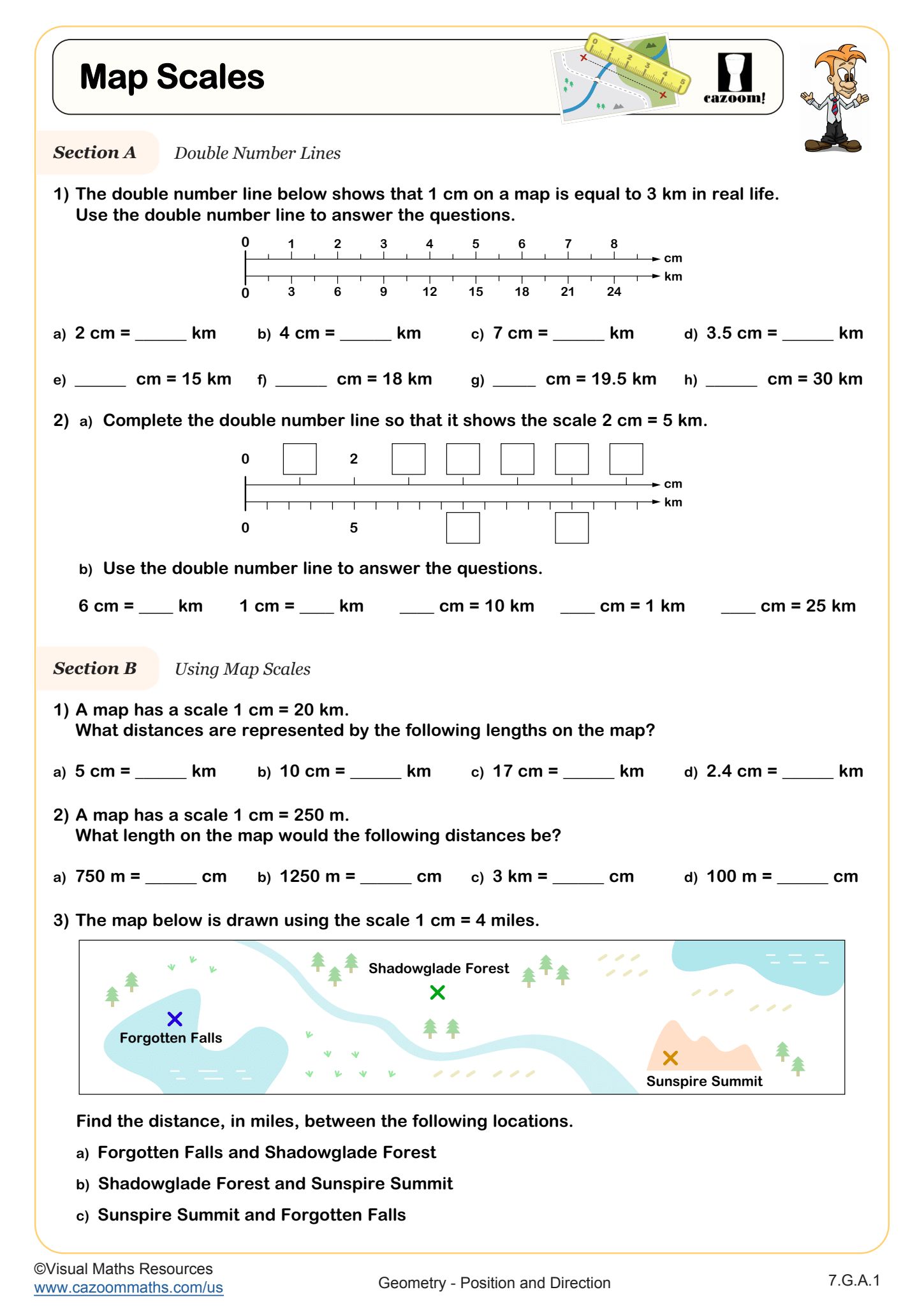
Map scales establish the ratio between distances on a map and actual distances in the real world, typically expressed as ratios like 1:50,000 or scale bars. Students learn to set up proportions to convert between map measurements and real distances, applying their ratio and proportion skills from earlier in 7th grade. This skill requires careful attention to units and multiplicative reasoning rather than additive thinking.
Map scales appear constantly in STEM careers, from urban planning and architecture to environmental science and emergency response. Civil engineers use scaled drawings to design roads and infrastructure, while geologists create topographic maps with precise scales to study landforms. GPS technology and digital mapping applications still rely on scale relationships, even when the calculations happen in the background. Understanding how scale works helps students interpret any visual representation of space, from blueprints to satellite imagery.
How Can Teachers Use These Position and Direction Worksheets Effectively?
The worksheets provide structured practice that builds from foundational skills like finding midpoints to more complex applications like calculating bearings with parallel lines. Teachers notice that students benefit from working through bearings problems in sequence, starting with simple north-based measurements before tackling problems that require understanding angle relationships in parallel lines. The answer keys allow students to check their work independently or enable quick feedback during guided practice.
Many teachers use these worksheets for differentiated instruction, assigning midpoint and basic bearing problems to students who need more foundational practice while challenging advanced students with bearing problems involving parallel lines. The worksheets work well for homework review, warm-up activities, or intervention sessions for students who performed poorly on coordinate geometry assessments. Paired work helps students explain their reasoning about direction and measurement, catching errors before they become ingrained habits.